Israel’s Map Error Ignites Diplomatic Row with India Over Jammu & Kashmir and Northeast Depiction
By: Javid Amin | Srinagar | 15 June 2025
When Lines on a Map Redraw Lines of Trust
What was meant to be a technical illustration of missile capabilities turned into a full-blown diplomatic embarrassment.
In the midst of its escalating conflict with Iran, the Israel Defense Forces (IDF) shared a missile range map designed to show Iran’s regional threat reach. However, instead of focusing attention on Iranian aggression, the post quickly sparked fury in India—not for its military implications, but for its erroneous depiction of Indian territory.
The graphic wrongly showed Jammu & Kashmir as part of Pakistan and depicted Northeast India within Nepal’s borders, striking a nerve in a country where sovereignty over borders is non-negotiable.
What followed was an avalanche of online outrage, diplomatic discomfort, and a formal apology from the Israeli military—a rare occurrence that reflects just how sensitive border issues are in the South Asian context.
What Happened – The Map, The Mistake, and The Meltdown
IDF’s Post Amid Escalating Iran Conflict
As part of its information campaign during the ongoing confrontation with Iran, the Israel Defense Forces shared a map illustration highlighting how far Iranian missiles could potentially reach across the Middle East and South Asia. The map was intended to demonstrate the geographic reach of threats facing Israel and its allies.
However, Indian netizens were quick to spot a glaring error: the map misrepresented the status of Jammu & Kashmir, showing the entire region as part of Pakistan, while also inaccurately placing large swathes of Northeast India inside Nepal’s territorial boundary.
The IDF’s official X (formerly Twitter) account, which posted the graphic, found itself flooded with comments, tags, and callouts from thousands of Indian users demanding immediate correction.
The Social Media Firestorm – Outrage in Real Time
Indian Users React Swiftly and Sharply
Within minutes of the graphic going live, Indian social media erupted with criticism:
-
“This is unacceptable. Jammu & Kashmir is an integral part of India,” one user wrote.
-
“Israel must fix this blunder. We are your friends, not to be disrespected like this,” said another.
-
Hashtags like #IDFApologise, #IndiaIsraelTies, and #MapError began trending.
Several influential accounts, including defense analysts, journalists, and strategic affairs commentators, joined the conversation, escalating the issue into a diplomatic flashpoint.
Tagging Diplomats and Officials
Many users directly tagged:
-
India’s Ministry of External Affairs (@MEAIndia)
-
Israeli Embassy in India (@IsraelinIndia)
-
Prime Minister Narendra Modi (@narendramodi)
-
Israeli PM Benjamin Netanyahu (@netanyahu)
The collective outcry pushed the IDF into responding publicly, a move rarely seen for visual errors on military informational posts.
The IDF’s Apology – Prompt But Problematic?
Official Statement from Israel Defense Forces
Under mounting pressure, the IDF issued an official clarification:
“This post is an illustration of the region. This map fails to precisely depict borders. We apologise for any offence caused by this image.”
While the apology was swift, it did little to fully address the core concern: misrepresentation of India’s sovereign territory in an official military post.
A Diplomatic Damage Control – Or Just a Technical Clarification?
Although the IDF’s apology acknowledged the error, critics pointed out that border depictions are not a trivial oversight, especially when coming from a national defense institution of a close ally.
India’s border sensitivities are well-known in the international community, particularly with respect to:
-
Pakistan-occupied Kashmir (PoK)
-
The Line of Control (LoC)
-
China’s encroachments in Ladakh and Arunachal Pradesh
In that context, such a glaring cartographic error from a friendly nation like Israel is viewed as more than a casual lapse—it’s seen as a symbolic slight, however unintended.
Why Borders Matter – India’s Cartographic Sovereignty
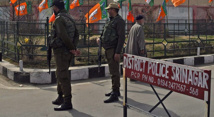
The Historic Sensitivity Around Jammu & Kashmir
India considers Jammu & Kashmir as its integral and inseparable part. Any misrepresentation—intentional or otherwise—of the region’s political status triggers public and governmental backlash.
Since the revocation of Article 370 in August 2019, the Indian government has vigorously asserted full territorial control over the region. The matter is also tied to India’s global positioning, where it resists any external involvement in what it deems internal affairs.
Map Politics in the International Arena
International companies like Google, Meta, and international media outlets have all, at some point, faced heat for inaccurate map depictions. The Indian government has, on numerous occasions:
-
Summoned foreign ambassadors
-
Issued formal demarches
-
Banned maps and apps that misrepresent the country’s borders
Given this backdrop, a military body posting such a map—even inadvertently—is not just a diplomatic faux pas; it’s a serious political flashpoint.
Political and Strategic Ramifications
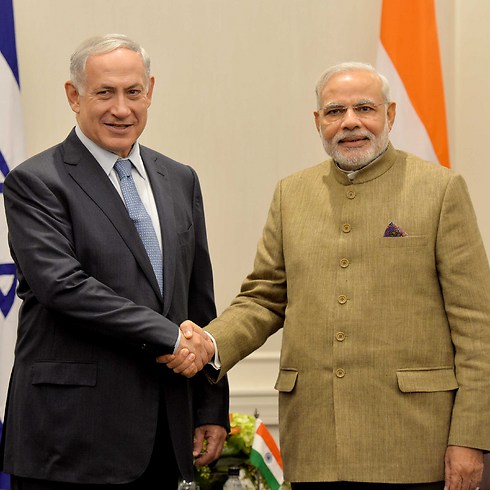
India-Israel Ties: A Traditionally Strong Bond
India and Israel share a historically strong relationship:
-
Defense Cooperation: India is among Israel’s top arms importers.
-
Strategic Dialogue: The two countries share intelligence on terrorism.
-
Agricultural & Tech Collaboration: Israel’s innovations help Indian farmers.
-
People-to-People Ties: Tourism, education, and business links flourish.
But in the current geopolitical climate—especially with Israel involved in a controversial war with Iran and Gaza—diplomatic sensitivities are heightened. Missteps, even unintentional, can cause domestic political pressure and public diplomacy setbacks.
The Risk of Diplomatic Fatigue
While Israel has been focused on its military survival amid Operation Rising Lion and Iran’s Operation True Promise, it cannot afford to alienate long-time allies like India.
India, on the other hand, has carefully walked a neutral line on the Israel-Palestine conflict, calling for restraint and a two-state solution. Mistakes like this add pressure on New Delhi to take a harder diplomatic stance—even if it prefers pragmatism over posturing.
Voices from India – What Leaders and Experts Are Saying
Politicians Weigh In
Some Indian opposition leaders were quick to jump on the issue:
“This is an insult to Indian sovereignty. If our close allies cannot get our map right, what message does it send to the world?” — Senior Congress leader
Meanwhile, the ruling BJP was measured but firm:
“We acknowledge the apology, but such mistakes should never happen. Jammu & Kashmir is non-negotiable,” said a BJP spokesperson.
Strategic Experts Speak
Defense analyst Lt. Gen. (retd.) P. K. Sehgal:
“This is not just a cartographic error—it reflects the need for better cultural and geopolitical awareness in allied militaries.”
Foreign affairs scholar Dr. Arpita Mishra:
“Israel must ensure that its communication, especially in the defense domain, undergoes better review. India’s borders are a national red line.”
Lessons and the Road Ahead
Why This Matters Beyond Borders
This incident highlights a deeper truth: In the digital age, every image, every map, and every post is a diplomatic statement. Inaccuracies carry consequences—not just in pixels, but in policies.
With India asserting its territorial integrity more vigorously than ever, friendly nations must take extra caution in official communications. The era of “approximate maps” is over—especially when shared by armed forces in an active conflict zone.
A Cautionary Tale for Allies Everywhere
This is not the first time India has had to correct a partner nation on its map. But the emotional and symbolic weight of Jammu & Kashmir in India’s national consciousness means that every misstep risks inflaming public sentiment.
Israel’s quick apology is welcome, but strategic communication and cultural sensitivity must improve. A strong friendship doesn’t mean room for recurring mistakes—it means greater responsibility and awareness.
Bottom-Line: When Allies Cross Lines—Even on Maps
The IDF’s map misrepresentation might seem like a technical error on the surface, but its implications run deep. In a region where maps are history, memory, and identity all rolled into one, misdrawing borders is tantamount to misunderstanding the people who live within them.
As India gears up for its growing global role—hosting international summits, sending spacecraft to the moon, and recalibrating foreign policy—its sensitivity to sovereignty will only grow sharper.
And while Israel remains a close and valuable ally, it has just learned a critical lesson: true friendship means knowing where to draw the line—and never crossing it.