URGENT WEATHER ALERT: NATURE’S FURY UNLEASHED ACROSS JAMMU & KASHMIR
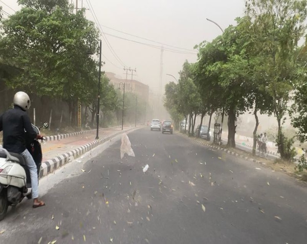
Srinagar, June 4, 2025: The skies over Jammu and Kashmir are morphing into a theater of meteorological violence. The Meteorological Department (MET) has escalated its warnings, predicting “severe gusty winds (50-70 kmph), large hail (2-4 cm diameter), and intense thunderstorms” across 11 districts within hours. This isn’t just rain—it’s a rapid-onset atmospheric assault with life-threatening potential.
THE EPICENTER: WHERE DANGER CONVERGES
Kashmir Valley: Ground Zero for Catastrophic Hail
-
Budgam & Ganderbal: Expect baseball-sized hail capable of shattering windows, crushing crops, and injuring livestock. Orchards in these districts face decimation within minutes.
-
North Kashmir (Baramulla, Kupwara): Wind tunnels will amplify gusts, turning loose debris into projectiles. River Jhelum’s tributaries may overflow within 3 hours of downpour.
-
South Kashmir (Pulwama, Anantnag): Flash flooding risk in low-lying areas like Bijbehara and Awantipora. Landslide alerts issued for hill slopes.
Chenab Valley: The Vortex Intensifies
-
Ramban & Doda: Hail cores will pivot here, with vertical wind shear creating “downbursts”—sudden 80 kmph downdrafts that flatten temporary structures. NH-44 (Srinagar-Jammu Highway) faces high disruption risk.
Jammu Region: Urban Flooding Crisis
-
Poonch/Rajouri: Thunderstorms with frequent cloud-to-ground lightning (3-5 strikes/minute).
-
Udhampur/Reasi: Waterlogging predicted in city centers within 60 minutes of rain onset. Grid stations vulnerable to outage.
THE STORM’S ANATOMY: WHY THIS IS A “MESOSCALE CONVECTIVE SYSTEM”
This isn’t routine rain. A high-altitude trough from Afghanistan is colliding with humid Punjabi air, creating explosive convection:
-
Supercell Formation: Rotating updrafts over Pir Panjal range spawn hailstones with layered ice cores.
-
Gust Front Mechanism: Cold air collapsing from storms accelerates winds ahead of the system—like an invisible tsunami.
-
CAPE Index: Convective Available Potential Energy exceeds 2500 J/kg (3× normal), fueling cloud tops at -60°C.
Dr. Faisal Ahmad, MET Srinagar: “These are ‘high-precipitation supercells’—rare for June. Hail will accumulate like snow, causing instant whiteout conditions on roads.”
CRITICAL IMPACTS: BEYOND THE OBVIOUS
| Sector | Immediate Threats | Long-Term Repercussions |
|---|---|---|
| Agriculture | Stone-fruit blossoms annihilated; Saffron fields buried under ice | 40% crop loss in apple belt; 15% price surge forecasted |
| Transport | Zero visibility on NH-1A; Flight diversions likely at Srinagar Airport | Highway closures may extend 48hrs for debris clearance |
| Infrastructure | Unreinforced mud roofs collapsing; Grid failures from pole damage | Post-storm mudslide risks in Banihal |
| Health | Hypothermia risk for shepherds; Injury from flying tin sheets | Water contamination from sewage overflow |
EXPERT-BACKED PRECAUTIONARY PROTOCOLS
For Citizens:
-
IMMEDIATE ACTIONS:
-
Move livestock to reinforced sheds now. Cover vehicles with hail blankets (6+ quilt layers).
-
Seal windows with adhesive tape to prevent glass shatter.
-
Fill bathtubs/containers—water supply may fail.
-
-
During Strike:
-
If outdoors: Crouch on balls of feet, head tucked (lightning posture).
-
Avoid bathing/plumbing—metallic pipes conduct strikes.
-
Farmers’ Emergency Plan:
-
Crop Armor: Deploy hail nets over orchards within 2 hours. No nets? Use jute sacks draped on poles.
-
Drainage Triage: Dig emergency runoff channels around fields.
-
Post-Storm: Spray copper oxychloride to prevent fungal blight in damaged crops.
Travel Survival Kit:
-
Must-haves: Tire chains, emergency beacon, thermal blankets, portable weather radio.
-
If stranded: Park away from trees, turn off ignition, stay in vehicle.
THE LONG GAME: WEATHER WHIPLASH AHEAD
-
June 5-8: Successive storm waves (72-hour cycle).
-
June 9-10: “False Calm”—deceptively dry but unstable. Brief showers may trigger landslides on saturated soils.
-
June 11+: Monsoon surge expected—flood prep advised.
GOVERNMENT RESPONSE: ALL HANDS ON DECK
-
NDRF: 4 teams prepositioned in Baramulla, Rajouri.
-
SDRF: Water rescue units deployed along Chenab banks.
-
Agricultural Hotline: 24/7 helpline +91-194-249-0000 for crop rescue guidance.
FINAL ALERT: THIS IS A CODE-RED SITUATION
Countdown Window: 90 minutes until first impacts in South Kashmir. Every second counts for preparation.
Stay Updated Via:
MET Office Twitter: @JammuKashmirMET
Disaster SMS Alerts: Text “JKWEATHER” to 19222
Emergency Broadcasts: All India Radio 100.1 FM
WHY THIS MATTERS: CLIMATE CHANGE CONNECTION
This event fits the trend of “compressed springs” in Himalayas—rapid warming (J&K temps +1.2°C since 2000) forces intense, short-duration storms. Researchers warn: *”What was once a 50-year event may now recur biannually.”*
Stay vigilant, stay safe. Nature’s wrath demands respect—not panic.


