Kashmir Floods: Why the Valley Remains Vulnerable 11 Years After 2014 — De-siltation, Floodplains, and the Price of Neglect
The Memory That Still Haunts the Valley
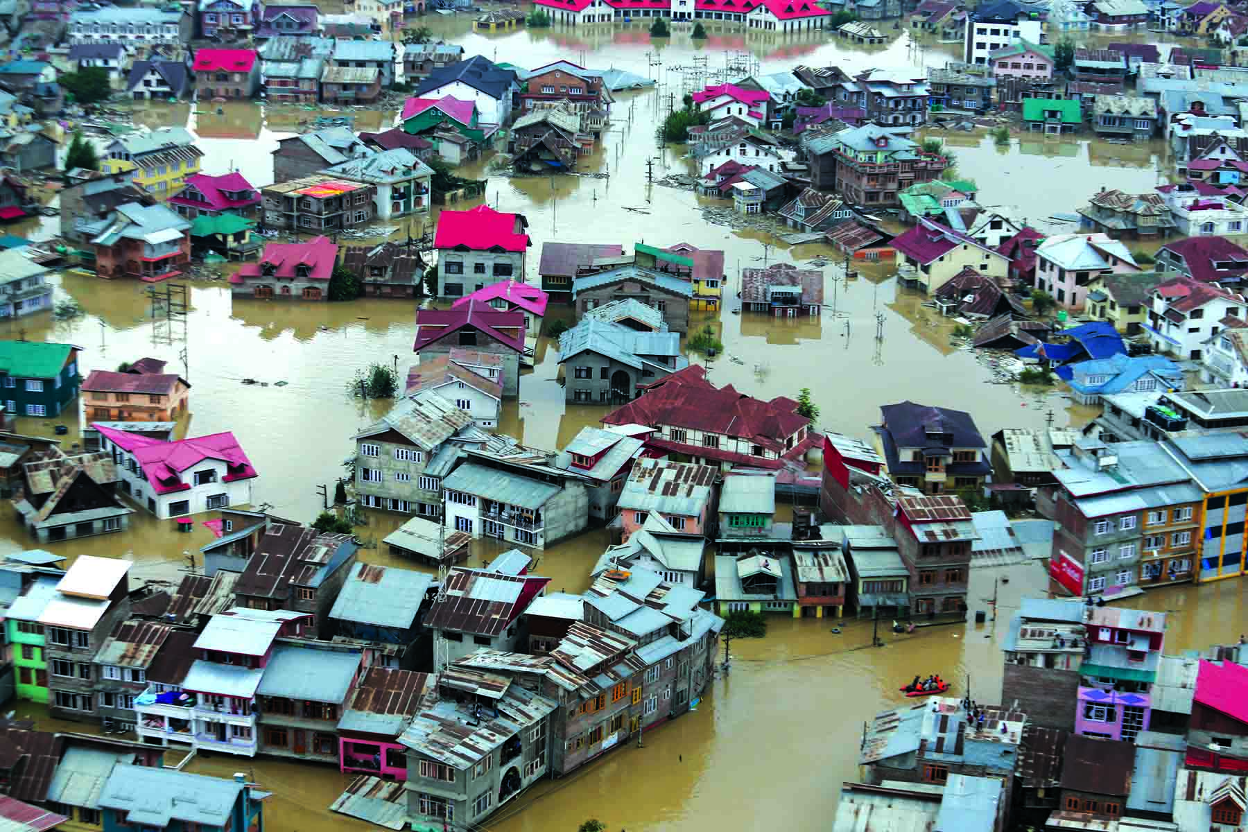
In September 2014, Kashmir witnessed one of the worst natural disasters in its recorded history. The Jhelum River swelled beyond its banks, swallowing homes, markets, schools, and entire neighbourhoods. Thousands were displaced, hundreds lost their lives, and the economic damage ran into billions.
Eleven years later, the scars remain — not just in memory, but in the Valley’s fragile flood management systems. The questions we must ask are uncomfortable but necessary:
- Why is Kashmir still so vulnerable to floods?
- What was done in the past decade to prevent a repeat of 2014?
- Where is the promised de-siltation work?
- Have our floodplains been conserved or destroyed by new infrastructure?
This is not just an environmental story — it’s a story of governance, planning, and the choices we make between short-term development and long-term survival.
The Anatomy of Vulnerability: Why Kashmir Floods So Easily
01 The Geography of Risk
Kashmir’s bowl-shaped valley, surrounded by the Pir Panjal and Zanskar ranges, is a natural flood basin. The Jhelum River, with its slow gradient, meanders through Srinagar before draining into Wular Lake. This geography means that once water levels rise, drainage is painfully slow.
02 Wetlands: Nature’s Flood Insurance
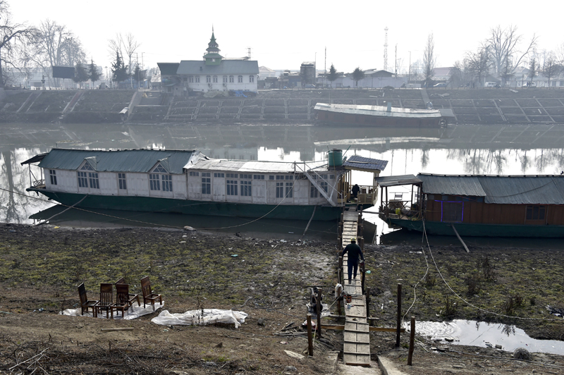
Historically, wetlands like Hokersar, Anchar, and Wular acted as natural sponges, absorbing excess water during heavy rains. Over the decades, these wetlands have been encroached upon, drained, or filled for agriculture and construction. The loss of these buffers has left the Valley exposed.
03 Urbanisation Without Planning
From 2000 onwards, Srinagar and its outskirts have seen a construction boom — housing colonies, shopping complexes, and road networks have mushroomed, often on reclaimed floodplains. This has blocked natural drainage channels and increased surface runoff.
04 Climate Change: The New Wild Card
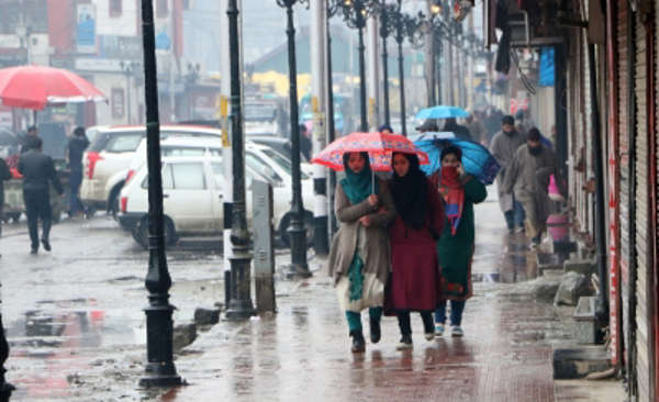
Erratic rainfall patterns, cloudbursts, and warmer winters have altered the Valley’s hydrological cycle. The intensity of rainfall events has increased, overwhelming existing flood control infrastructure.
The 2014 Floods: Lessons Written in Water
The 2014 floods were not just a natural disaster — they were a governance disaster. Reports after the event highlighted:
- Poor maintenance of the Jhelum’s flood spill channel.
- Encroachments on riverbanks and wetlands.
- Lack of early warning systems and disaster preparedness.
The tragedy was a wake-up call — or at least, it should have been.
Eleven Years Later: What Was Promised vs. What Was Delivered
01 The Promises
After 2014, the government announced a series of measures:
- Comprehensive dredging of the Jhelum and its tributaries.
- Restoration of wetlands and flood channels.
- Construction of an alternate flood channel.
- Strengthening of embankments.
- Modern flood forecasting and early warning systems.
02 The Reality
While some dredging was carried out, it was sporadic and insufficient. Wetland restoration projects were launched but lacked scale and enforcement. The alternate flood channel remains largely on paper. Embankments have been repaired in patches, but without addressing the root causes of vulnerability.
De-siltation: The Missing Link in Flood Prevention
01 Why De-siltation Matters
Siltation reduces the carrying capacity of rivers and flood channels. In the Jhelum, decades of neglect have allowed silt to accumulate, raising the riverbed and making floods more likely.
02 The Status of De-siltation Work
Post-2014, dredging contracts were awarded, but progress has been slow. In some stretches, dredging was abandoned midway due to technical or financial issues. Without sustained de-siltation, the Jhelum remains a ticking time bomb.
Floodplains: Conserved or Consumed?
01 The Role of Floodplains
Floodplains are nature’s overflow zones. Building on them is like blocking a safety valve — the water has nowhere to go but into homes and streets.
02 The Reality on the Ground
In the past decade, new bridges, flyovers, ring roads, and housing colonies have been built on or near floodplains. Each project chips away at the Valley’s natural flood resilience.
Timeline of Major Flood Events — 2014 to 2025
Kashmir Flood Timeline — Lessons Unlearned
| Year | Event | Key Notes |
|---|---|---|
| 2014 | September Mega Flood | Jhelum breaches all records; Srinagar submerged; 300+ dead; economic loss ₹1 trillion+. |
| 2015–2016 | Post-Flood Promises | Govt announces dredging, alternate flood channel, wetland restoration. |
| 2017 | Partial Dredging | Work begins but slows due to funding and technical issues. |
| 2018 | Localized Flooding | Heavy rains cause inundation in Bemina, Rajbagh. |
| 2019 | Encroachment Surge | New colonies, roads on floodplains despite warnings. |
| 2020 | COVID-19 Distraction | Flood management projects stall. |
| 2021 | Wetland Loss Accelerates | Hokersar shrinks; encroachments rise. |
| 2022 | Cloudburst Events | Ganderbal, Kulgam hit by flash floods. |
| 2023 | Drainage Crisis | Srinagar paralysed by urban flooding after moderate rain. |
| 2024 | Flood Action Plan Drafted | Identifies 37 high-risk zones; limited implementation. |
| 2025 | September High Alert | Jhelum above danger mark; multiple districts inundated; preparedness tested again. |
Infographic — Jhelum River: Water Levels vs. Carrying Capacity
Sections:
- Safe Level: Up to 18 ft at Ram Munshi Bagh (green zone).
- Warning Level: 18–20 ft (yellow zone).
- Danger Level: Above 20 ft (red zone).
Data Points for 2025 Event:
- Sangam: Danger mark 21 ft — current 27.15 ft.
- Ram Munshi Bagh: Danger mark 20 ft — current 20.54 ft.
Inset Graphic:
- Cross-section of Jhelum channel showing:
- Original depth & width (pre-1990s) — higher capacity.
- Current silted profile — reduced depth, narrower flow.
- Labels showing % capacity lost due to siltation and encroachment.
Every foot of lost depth reduces the Jhelum’s flood-carrying capacity by thousands of cubic metres — turning heavy rain into a disaster trigger.
The Way Forward: Building True Flood Resilience
- Strict enforcement of floodplain zoning laws.
- Large-scale wetland restoration with community participation.
- Continuous de-siltation as a permanent maintenance activity.
- Climate-adaptive infrastructure that works with, not against, natural systems.
- Transparent audits of all flood management projects.
Bottom-Line: The Choice Before Us
Kashmir stands at a crossroads. We can continue with piecemeal measures and hope for the best, or we can commit to a comprehensive, science-based flood management strategy. The 2014 floods were a tragedy. A repeat would be a failure — not of nature, but of our will to act.