IMD Predicts Another 2-Day Wet Spell in Kashmir as Valley Sees Slight Rise in Temperatures
By: Javid Amin | 25 January 2026
Despite Marginal Warming, Severe Chillai Kalan Conditions Persist; Rain and Snow Forecast for Jan 26–27, 2026
Fresh Weather Forecast: Another Wet Spell Ahead
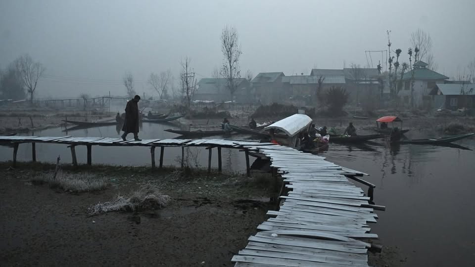
The India Meteorological Department (IMD) has forecast a fresh 2-day wet spell over the Kashmir Valley beginning January 26, 2026, bringing rain and snowfall to various parts of Jammu & Kashmir.
Meteorologists say this new spell is associated with an ongoing Western Disturbance, which has already triggered heavy snow, gusty winds, and extensive road and power disruptions across the region in recent days. The incoming activity is expected to affect travel, infrastructure, and daily life even further.
Slight Temperature Rise Offers Marginal Relief
While the Valley continues to endure severe winter conditions, there was a small overnight rise in minimum temperatures on Sunday — offering slight relief from intense cold.
According to IMD data:
-
Srinagar recorded a low of -1.6°C
-
Qazigund registered -3.1°C
-
Kupwara logged -3.5°C
-
Pahalgam saw -6.2°C, an improvement from -7.6°C a night earlier
-
Kokernag settled at -5.0°C
-
Gulmarg, the ski resort and one of the highest altitude stations, was the coldest place at -10.2°C, compared with -12.0°C previously
The upward tick in nighttime lows does not signal an end to winter’s grip; rather it reflects modest variability within a persistently cold period.
Understanding Chillai Kalan: The Harsh Winter Core
Kashmir is midway through Chillai Kalan, a traditional 40-day period of severe winter that typically lasts from December 21 to January 31.
Key characteristics of Chillai Kalan:
-
Prolonged sub-freezing temperatures
-
Deep fog and frost in lowland areas
-
Heavy snow in higher reaches
-
Increased heating demand and energy use
-
Heightened risk to infrastructure and vulnerable populations
As of Sunday, meteorological records show 35 of the 40 days of Chillai Kalan have been completed, underscoring how deep into winter the region remains even as nights warm slightly.
Why the Slight Warming Matters, But Isn’t a Trend Shift
Experts caution that a minor rise in minimum temperatures — especially within the frame of freeze conditions — does not equate to a lasting warm spell. Rather, it may result from temporary atmospheric changes such as:
-
Increased cloud cover trapping heat at night
-
Slight shifts in wind patterns
-
Reduction in radiative cooling
Even with these marginal increases, the broader freeze pattern remains intact, particularly in higher reaches and sheltered valleys.
Impact of Forecast Wet Spell (Jan 26–27)
Rain and Lower Elevations
-
Light to moderate rainfall expected in plain areas including Srinagar and surrounding districts.
-
Roads, pavements, and low-lying routes may become slippery.
Snow in Higher Altitudes
-
Snowfall predicted in elevated regions such as Gulmarg, Sonamarg, and areas near the Line of Control.
-
Avalanche warnings may be reissued in susceptible higher slopes (e.g., Gurez, Tulail).
Public Advisory: Prepare, Don’t Panic
IMD and local authorities have issued precautionary advisories ahead of the forecast wet spell:
For Residents and Travellers
-
Avoid unnecessary travel during active weather periods.
-
Follow local hazard warnings related to snow, rain, and wind.
-
Monitor updates from IMD and district administration.
For Vulnerable Communities
-
Ensure adequate heating fuel and insulation in homes.
-
Check on elderly, young children, and those with health conditions.
-
Stock essential supplies in case of transport or service disruption.
Ground Conditions: Weather and Daily Life
The ongoing winter scenario is already affecting life across the Valley:
Infrastructure
-
Frequent power outages due to heavy snow and wind damage.
-
Road closures, especially the Srinagar–Jammu National Highway (NH-44), remaining shut at multiple points.
Transport
-
Flights have continued with intermittent disruptions.
-
Rail services on the Banihal–Baramulla section remain suspended due to snow cover on tracks.
Tourism
-
Snow-laden destinations like Gulmarg and Sonamarg see increased winter visitors, though access roads are intermittently blocked.
What This Means for Kashmir’s Winter Pattern
The convergence of a continued cold spell, fresh snowfall, gusty winds, and a predicted 2-day wet phase illustrates the complexity and persistence of winter weather in Kashmir:
-
Persistent Freeze: Even with slight nocturnal warming, daytime and nighttime temperatures remain deeply below seasonal norms in many areas.
-
Active Weather Events: Multiple Western Disturbances in close succession heighten variability and hazard potential.
-
Infrastructure Stress: Roads, power lines, and public services remain under strain from recurring weather impacts.
-
Human Impact: Daily life, commute, and supply chains are continuously challenged by prolonged winter conditions.
Conclusion: Winter Remains Unyielding
While Kashmir is registering a marginal uptick in overnight lows, the region remains firmly in the grip of winter. The forecast of another 2-day wet spell — combining rain and snow — signals further disruption ahead before the season turns.
For residents, travelers, and businesses alike, preparedness and caution remain essential. The slight temperature rise offers momentary relief but not respite: winter in Kashmir continues to test endurance, infrastructure, and everyday routines.


