Dense Fog Disrupts Kashmir as Back-to-Back Western Disturbances Signal a Snowy Turn
By: Javid Amin | 18 December 2025
Kashmir is entering a critical weather transition, marked by dense fog, plunging night temperatures, and the imminent onset of Chillai-Kalan, the Valley’s harshest 40-day winter period. As residents grapple with freezing nights and poor visibility on roads, the Meteorological Department (IMD) has forecast two back-to-back Western Disturbances (WDs) that are likely to end the prolonged dry spell and bring much-awaited rain and snowfall across the region.
The convergence of fog, frost, and fresh snow systems is already testing traffic, infrastructure, and daily life—offering a preview of the challenges that lie ahead as Kashmir braces for deep winter.
Dense Fog Brings Kashmir to a Crawl
Visibility Drops Below 50 Metres
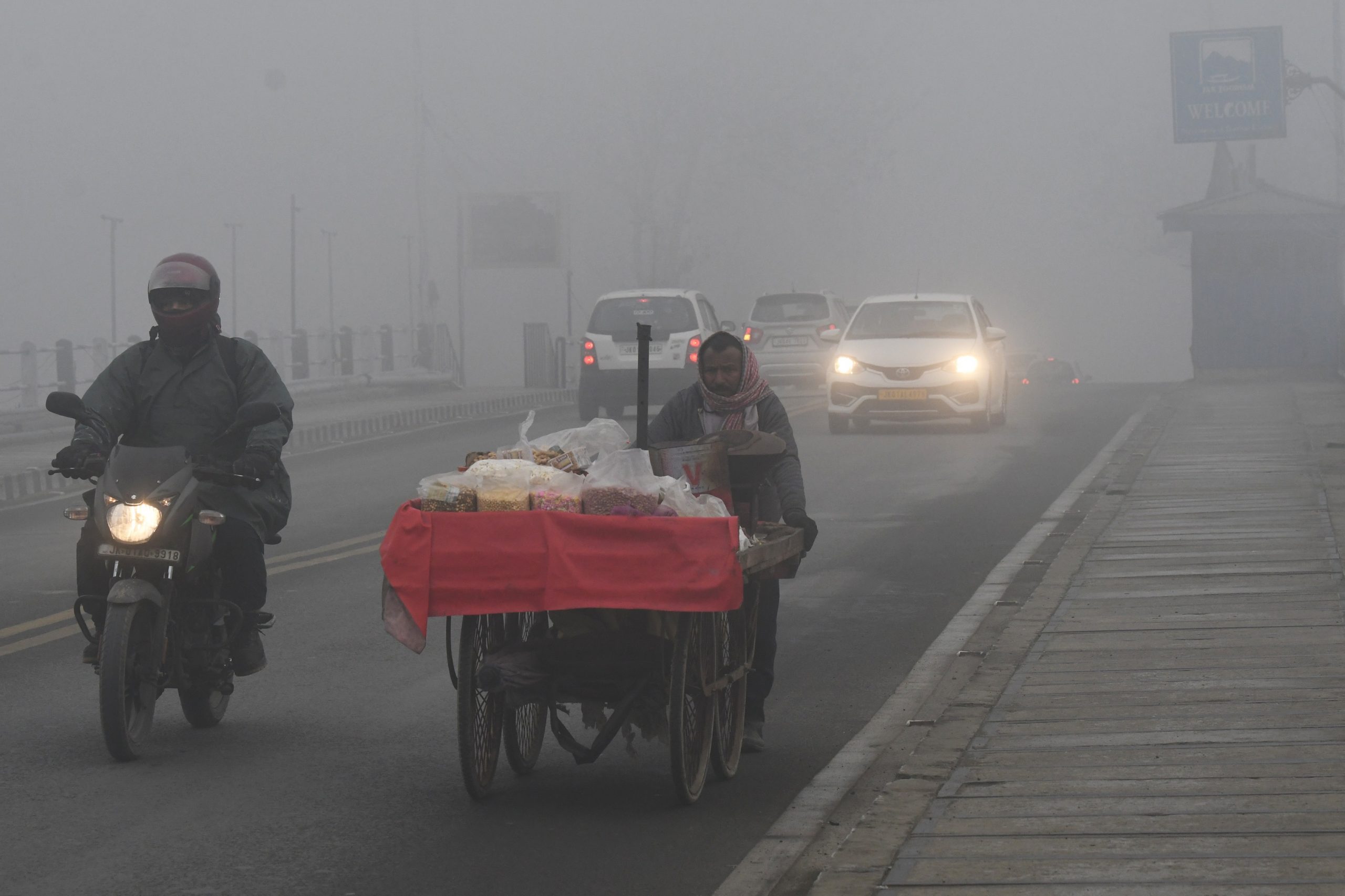
Early mornings across the Valley have been marked by thick, persistent fog, reducing visibility to less than 50 metres in several areas. Major road corridors affected include:
-
Srinagar–Jammu National Highway
-
Pulwama–Kulgam road
-
Baramulla–Handwara stretch
Drivers reported near-whiteout conditions, with headlights barely piercing the fog.
Traffic Police Step In
In response, traffic authorities deployed additional personnel at vulnerable stretches, slowing movement and diverting vehicles where necessary to reduce accident risk.
Fog-related disruptions are particularly dangerous in Kashmir due to:
-
Narrow roads
-
Sharp curves
-
Early morning black ice formation
Officials have urged commuters to avoid unnecessary travel during early hours.
Night Temperatures Plunge Across the Valley
Sub-Zero Nights Signal Winter’s Grip
Alongside fog, night temperatures have dropped sharply, reinforcing the sense that winter has fully arrived.
Recorded Minimum Temperatures:
-
Srinagar: 0.2°C
-
Awantipora: −3.8°C
-
Pulwama: −3.2°C
-
Pampore: −1.8°C
Frost was reported in orchards and open fields, particularly in south Kashmir districts.
Meteorologists say the combination of clear nights, calm winds, and dry air has accelerated heat loss from the surface, pushing temperatures below freezing in several pockets.
Chillai-Kalan Approaches: Kashmir’s Harshest Winter Phase
What Is Chillai-Kalan?
Beginning December 21, Chillai-Kalan lasts 40 days, traditionally considered the coldest and most severe phase of Kashmir’s winter.
It is typically characterised by:
-
Persistent sub-zero nights
-
Frequent snowfall
-
Frozen water bodies
-
Icy roads and pipes
While recent years have seen fluctuations due to climate change, this period still defines winter preparedness across the Valley.
Residents are now switching fully into winter survival mode, insulating homes, rationing fuel, and adjusting daily routines.
Western Disturbances Set to End the Dry Spell
Two Systems, Back-to-Back
After an unusually long dry stretch since November, the IMD has forecast two consecutive Western Disturbances that are expected to finally alter Kashmir’s weather pattern.
First WD
-
Arrival: Night of December 20
-
Impact:
-
Light to moderate snowfall in higher reaches
-
Rain or snow in plains
-
-
Significance: Breaks the prolonged dry spell
Second WD
-
Timeline: December 22–23
-
Impact: Reinforces precipitation
-
Outcome: Sustained cloud cover and continued snowfall
Together, these systems are expected to establish a winter regime, rather than a brief weather interruption.
Snowfall Outlook: Higher Reaches to See Accumulation
Where Snow Is Expected
Higher reaches above 3,200 metres, including:
-
Kupwara
-
Bandipora
-
Ganderbal
-
Zojila axis
may receive moderate to heavy snowfall, particularly during the second WD.
Lower elevations, including Srinagar, are likely to see rain, sleet, or wet snow, depending on temperature variations.
Weather Highlights at a Glance
| Event | Details | Impact |
|---|---|---|
| Dense fog | Visibility <50m | Traffic delays, accident risk |
| Night temperatures | Down to −3.8°C | Frost, cold stress |
| Chillai-Kalan | Dec 21 – Jan 30 | Severe winter conditions |
| First WD | Dec 20–21 | Ends dry spell |
| Second WD | Dec 22–23 | Sustained precipitation |
Risks and Immediate Concerns
Travel Disruptions
The combination of fog, snow, and freezing temperatures is likely to:
-
Disrupt highway traffic
-
Trigger temporary road closures
-
Delay public transport
The Srinagar–Jammu highway remains particularly vulnerable.
Power and Heating Stress
Early indicators suggest that winter electricity demand may outpace supply, especially during snowfall episodes, increasing dependence on traditional heating methods.
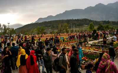
Tourism: Opportunity and Risk
While snowfall boosts winter tourism, especially in Gulmarg, fog and icy roads raise safety concerns for visitors unfamiliar with mountain conditions.
Environmental Context: From Dry Spell to Snow Cycle
The expected snowfall is environmentally significant.
After weeks of:
-
Low river flows
-
Dry soils
-
Rising air pollution
snowfall will:
-
Recharge water sources
-
Improve soil moisture
-
Help disperse trapped pollutants
Environmental experts caution, however, that episodic snowfall does not undo long-term climate shifts, but it provides critical short-term relief.
A Delicate Transition into Deep Winter
Kashmir’s current weather represents a threshold moment—the shift from delayed winter to full seasonal intensity.
Dense fog reflects stagnant cold air.
Freezing nights signal deepening cold.
Western disturbances promise snow and disruption.
Together, they mark the Valley’s entry into its most demanding season.
Bottom-Line: Winter Arrives in Layers, Not All at Once
Kashmir is not stepping into winter quietly. It is arriving through fog-clogged roads, freezing nights, and snow-bearing skies.
As Chillai-Kalan begins, the Valley stands at the intersection of relief and risk—relief from a long dry spell, and risk from harsh conditions that test resilience every year.
The coming days will define how smoothly Kashmir transitions into deep winter. One thing is certain: the season has finally asserted itself.