First Major Rain and Snow Spell May Arrive From October 8 as Western Disturbance Approaches
By: News Desk | 02 October 2026
Srinagar: Jammu and Kashmir could see its first significant spell of autumn rain and snowfall between October 8 and 11, with an approaching Western Disturbance potentially changing the weather pattern after several mostly dry days.
The early forecast indicates that snowfall is likely to remain concentrated over the higher reaches, while rain could affect the plains and lower elevations. The current possibility of the broader precipitation spell has been put at around 55% by Kashmir Weather Forecast, although forecasters have stressed that the timing, intensity and geographical spread could change as the system comes closer.
The forecast is significant not simply because of the prospect of the season’s first widespread snow, but because October marks a transition period in Kashmir. The landscape is still in its autumn phase, tourist activity remains substantial, horticultural operations are underway and mountain routes can become increasingly sensitive to weather changes as temperatures fall.
At the same time, the current picture does not yet amount to an official severe-weather warning. The India Meteorological Department’s subdivision-wise warning page issued on October 3 showed no warning for Jammu and Kashmir through October 9. That distinction matters: the October 8–11 spell is currently an evolving forecast signal rather than a settled event.
J&K Weather Forecast: Mostly Dry Conditions Likely Before the Change
For the immediate period, Jammu and Kashmir is expected to remain largely dry.
The forecast circulating on October 1 indicated mostly dry weather through around October 5, followed by a possible change from October 8 as a stronger Western Disturbance approaches the region.
The contrast between the present conditions and the possible weather change is already visible in the latest observations.
According to weather parameters reported from the IMD on October 1, Srinagar recorded a maximum of 29.3°C and a minimum of 10.2°C, while Jammu touched 32.6°C during the day. Gulmarg recorded 20.6°C and Pahalgam 25.5°C as maximum temperatures, with their respective minimums at 7.2°C and 6°C. No rainfall was recorded at the listed stations during that observation period.
That relatively warm daytime pattern is typical of the transition period. A shift toward cloud cover, precipitation and colder air would therefore be noticeable, particularly in the mountains.
What Is a Western Disturbance — and Why Does It Matter to Kashmir?
The phrase Western Disturbance often appears in Kashmir weather reports, but its significance goes far beyond a routine forecast term.
The India Meteorological Department describes Western Disturbances as weather systems embedded in the mid-latitude westerlies that move eastward towards northern India. They are associated with precipitation across the Western Himalayan region, including Jammu and Kashmir.
These systems can bring different forms of precipitation depending on altitude and atmospheric conditions.
At lower elevations, the same system may produce rain. As elevation rises and temperatures fall, precipitation increasingly occurs as snow. That is why a single Western Disturbance can produce rain in Srinagar while bringing snowfall to Gulmarg, Sonamarg, higher Pir Panjal areas and other mountain zones.
Research published in the IMD’s MAUSAM journal also shows how closely Western Disturbances are linked with precipitation variability in Jammu and Kashmir. A study covering 1980–2019 found a positive relationship between Western Disturbance frequency and precipitation across the region, while documenting substantial variation between stations and months.
For the Western Himalaya, these systems are therefore not just short-term weather events. They are an important part of the region’s wider water cycle.
Snowfall Likely to Stay Above the Valley Floor
One of the most important details in the current forecast is the expected altitude difference in precipitation.
The early assessment indicates that snowfall should mainly affect higher reaches, while the plains and lower-lying areas are more likely to receive rain.
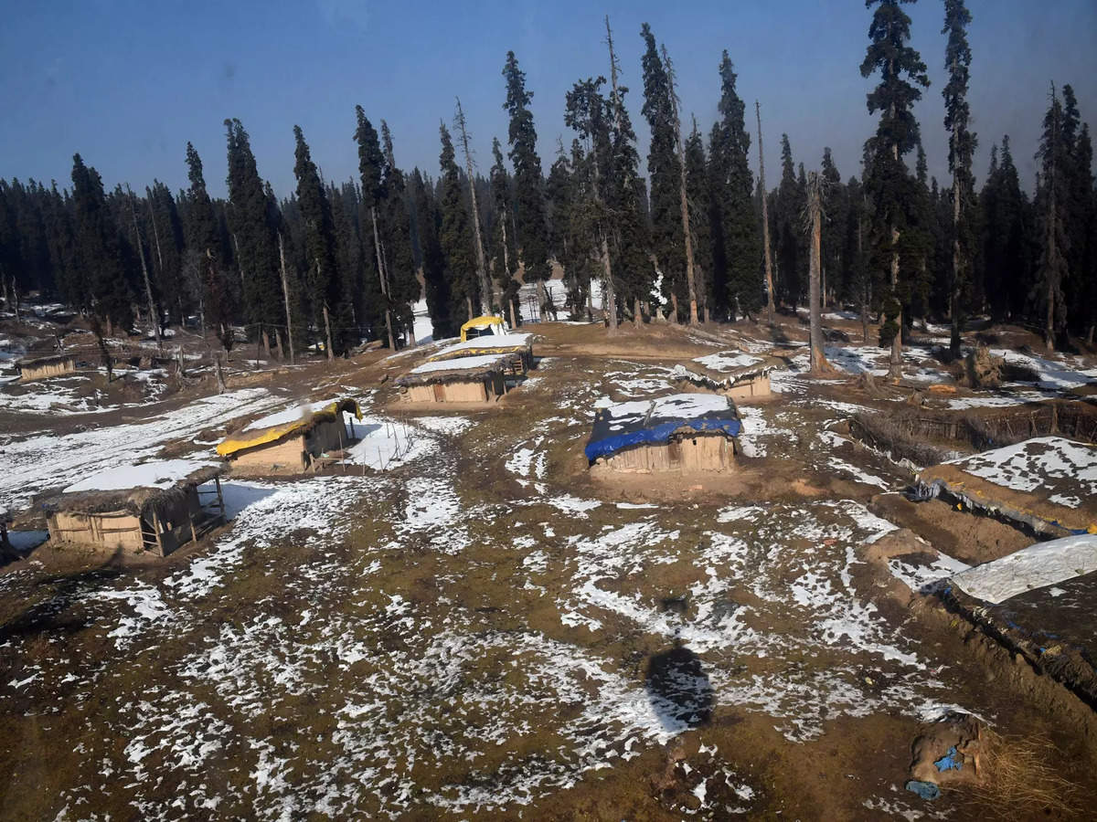
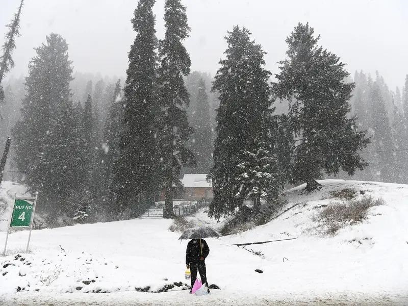
That means the first photographs of fresh seasonal snow are more likely to emerge from mountain destinations than from Srinagar or other valley-floor locations.
Areas such as Gulmarg, Sonamarg, Peer Ki Gali and other elevated mountain belts could see wintry conditions if temperatures fall sufficiently during precipitation.
But it would be premature to assume that every listed destination will receive substantial accumulation.
Snowfall depends on several variables — including the exact track of the disturbance, moisture availability, temperature profile, freezing level and duration of precipitation. A change in any of these factors can alter where rain changes to snow and how much snow actually accumulates.
This is also why early long-range snowfall forecasts should not be interpreted as a guarantee of a snow-covered Kashmir Valley.
Why the 55% Figure Needs Context
The widely circulated 55% probability deserves some explanation.
It is not an IMD warning level and should not be interpreted as a guarantee that a major four-day snowstorm will occur.
The figure comes from the early assessment attributed to Kashmir Weather Forecast, which described the possibility of the season’s first major rain-and-snow spell during October 8–11 at around 55%. The same forecast explicitly cautioned that the timing and intensity could change as the system approaches.
Meanwhile, the official IMD warning page available on October 3 listed “No warning” for J&K for October 3 through October 9.
There is no contradiction in these two pieces of information.
A medium-range forecast can identify a potential weather system before it becomes close enough for an official warning to be issued. As the event gets nearer, meteorological agencies can refine the forecast based on newer model runs, atmospheric observations and the system’s actual movement.
For residents and travellers, that means the next few forecast updates will be more informative than today’s headline alone.
What Could It Mean for Kashmir Tourism?
If the system develops broadly as currently indicated, the tourism sector could receive an early taste of the coming winter season.
October is already an important tourism month in Kashmir. The valley’s autumn colours, relatively comfortable daytime temperatures and mountain landscapes attract visitors before the deeper winter sets in.
Fresh snowfall in higher destinations would add another dimension.
But there is an important distinction between early snowfall tourism and the fully established winter season.
A snowfall spell in October does not mean that ski season has begun, nor does it guarantee lasting snow cover. Conditions at Gulmarg and other high-altitude destinations can change rapidly during autumn.
Travel companies promoting an “early snowfall” experience should therefore avoid presenting the forecast as guaranteed snowfall. A more accurate approach is to market the period as an early-season Kashmir weather experience, with snow opportunities subject to actual conditions.
Roads and Mountain Travel Could Be the Bigger Concern
For travellers, the most immediate practical issue may not be snowfall itself but road conditions.
Mountain passes and elevated roads can become slippery during rain or snow. Visibility may also deteriorate during periods of cloud, precipitation or fog. If the system becomes stronger than currently anticipated, temporary restrictions on vulnerable routes are possible.
That does not mean that travel between October 8 and 11 should automatically be considered disrupted. At present, there is no basis for making that claim.
Instead, travellers heading towards high-altitude destinations should check the latest weather and traffic advisories immediately before departure.
The lesson from previous Western Disturbance events is clear: weather impacts in the mountains can develop quickly. Historical IMD documentation records instances in which heavy precipitation associated with Western Disturbances affected roads in the Western Himalaya.
The Environmental Side: Snow Is More Than a Tourism Photograph
The arrival of autumn snowfall also has a much larger environmental significance for Kashmir.
Winter precipitation is an important component of the hydrological system of the Western Himalaya. The Union government’s Ministry of Earth Sciences has noted that around 30% of annual precipitation in the north-western Indian region, including J&K, Ladakh, Himachal Pradesh and Uttarakhand, occurs during winter and is mostly associated with Western Disturbances.
Snow stored at higher elevations can later contribute to streamflow and water availability as temperatures rise.
For Kashmir’s mountain ecosystems, therefore, snowfall is not simply a tourism asset. It is part of the seasonal water budget.
The timing, amount and persistence of snow matter.
A short early-season snowfall followed by prolonged warmth has a very different hydrological effect from sustained winter snow accumulation. Likewise, heavy rain falling where snow would normally be expected can influence runoff, soil moisture and the timing of meltwater.
This is particularly relevant as researchers continue to examine changing precipitation patterns across the Himalaya.
Agriculture and Horticulture Are Also Watching the Sky
Kashmir’s horticulture economy is deeply connected to weather.
October is an important period for apple harvesting and other agricultural activities. Rain can influence harvesting schedules, transport and orchard operations, while cold conditions can create different risks depending on their timing and intensity.
A moderate precipitation spell can replenish soil moisture after dry conditions, but excessive rainfall or abrupt weather changes can create operational difficulties for farmers.
The relationship between Western Disturbances and precipitation is therefore not simply a question of whether the weather is “good” or “bad.” The consequences depend on when the precipitation arrives, how intense it is and how long it lasts.
That nuance becomes particularly important during transitional seasons such as October.
Could This Be the Start of Kashmir’s Winter?
It may be a sign of the seasonal transition, but it would be too early to declare the arrival of winter based on one forecast window.
The meteorological calendar and the popular perception of Kashmir’s winter do not begin on the same date.
An October Western Disturbance can produce snow at high elevations while Srinagar remains relatively mild. Several subsequent dry or warmer periods can follow before persistent winter conditions become established.
In other words, the first significant snowfall at altitude is not necessarily the beginning of sustained winter across Kashmir.
What it can signal is a change in the region’s atmospheric regime as the post-monsoon period gives way toward the colder months.
What Travellers Should Watch Between Now and October 8
The forecast will become more useful as the event approaches.
Visitors planning Kashmir trips around October 8–11 should watch for:
- Updated IMD forecasts and district-level weather advisories.
- Changes in the expected track and intensity of the Western Disturbance.
- Snowfall forecasts for Gulmarg, Sonamarg and higher mountain areas.
- Traffic advisories for mountain roads and passes.
- Temperature forecasts, particularly overnight temperatures.
- Any advisories affecting trekking, sightseeing or high-altitude travel.
Most importantly, travellers should distinguish between a forecast of possible snowfall and an official advisory confirming hazardous conditions.
What This Means for Kashmir’s Early-Winter Tourism Market
For Kashmir’s travel industry, the developing forecast provides an opportunity — but also a reason for responsible communication.
Travel companies can begin preparing early-season packages around themes such as “Winter in Kashmir,” “Early Snowfall Kashmir,” “Gulmarg Snow Experience” and “Autumn-to-Winter Kashmir.”
However, promotional material should clearly distinguish between expected and confirmed conditions.
A responsible campaign could say that travellers visiting during the October 8–11 window may experience the season’s first snowfall in higher reaches if the forecast materialises, rather than guaranteeing snow.
That distinction protects both travellers and businesses.
For a destination whose tourism appeal is heavily influenced by weather, accurate communication is part of the product.
The Bigger Picture: Kashmir’s Weather Is Becoming a Forecast to Watch More Closely
The significance of the October forecast extends beyond a few days of rain and snow.
Jammu and Kashmir sits in a geographically sensitive part of the Western Himalaya, where small changes in temperature and precipitation can produce dramatically different conditions across relatively short distances.
Rain in Srinagar can coincide with snow just a few thousand metres higher. A passing system can improve soil moisture in one location while creating road or landslide concerns elsewhere. A snowfall event that looks spectacular to visitors can simultaneously become an important component of the region’s seasonal water storage.
Scientific research has also highlighted considerable variability in Western Disturbance activity and precipitation across Jammu and Kashmir rather than a uniform pattern across the entire region.
That makes localised forecasting increasingly important.
For now, the October 8–11 scenario remains a developing weather possibility rather than a confirmed major snow event. The independent forecast signal is strong enough to watch, but the absence of an IMD warning as of October 3 underlines why travellers and residents should wait for subsequent updates before making assumptions about the eventual intensity.
If the Western Disturbance strengthens and moves across the region as currently indicated, the higher mountains could receive Kashmir’s first notable taste of the coming winter — while the Valley floor experiences a spell of rain and falling temperatures.
The real story, however, will be written by the atmosphere over the next several days.