Arif Shafi Wani
As experts have been warning of major earthquakes of high magnitude in Jammu and Kashmir without any specific timeframe as it falls in high seismic zones, experts are worried over high tectonic activity coupled with soil erosion in quake vulnerable areas of J&K.
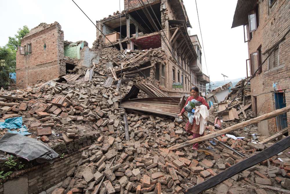
J&K falls under the high seismic Zones IV and V making it vulnerable to earthquakes. A powerful 7.6 magnitude earthquake rattled J&K on October 8, 2005, claiming 1350 lives and causing massive destruction to structures.
The vulnerability of J&K is in focus after a devastating earthquake of 7.8 magnitude rocked Turkey and Syria on February 6, leaving around 11,000 dead while hundreds of buildings collapsed.
A study by a prominent US-based seismologist Roger Bilham has warned that Kashmir valley is likely to be hit by an earthquake of largest ever magnitude 9, but did not specify any timeframe.
Experts, who have been monitoring the situation in J&K, are concerned over increasing tectonic activity in quake vulnerable areas like Pir Panjal and Zankar range of mountains. “Tectonic activity besides frequent quakes coupled with soil erosion in quake prone areas in the Pir Panchal and Zanskar range of mountains are worrying indicators. Studies and indicators point towards the likelihood of a high magnitude quake in J&K, but we can’t say when,” noted Geoscientist Abdul Majid Butt told KIF.
“I have closely studied Geomorphology of these areas underground and on surface practically. The stability of the region geologically is very fragile. Need is consolidation than acts which cause soil erosion ultimately leading to instability. Plates have added up huge underground pressure which need vent to cause tremor,” he said.
Butt, a retired KAS officer, has worked in various projects in Doda, mining operations in connecting Banihal and Qazigund for mining of Gypsum at Assar and Baggar cement plants for over two decades.
He was general manager of world famous sapphire mines at earthquake prone Padder for over a decade.
Recently big cracks in several houses in the mountainous Nai Basti area of Thathri in Doda district of Jammu created panic among the residents. The situation was similar to Joshimath, a hilly town in north Indian state of Uttarakhand a few months ago where over 1000 houses cracked, crumbled, and caved in, rendering families homeless.
Doda has emerged as one of the most eco-fragile areas in J&K due to its unique geoclimatic conditions. It is prone to earthquakes and witnesses frequent low intensity quakes.
Elaborating, Butt said study of geological joints along Srinagar-Jammu National Highway calls for rockbolting and shortcreting so that percolating waters along fissures may not add up as accelerating agents in absence of drainage.
“It is ironic that registered qualified persons certified by Indian Bureau of Mines to monitor Environment Impact Assessment by an act of Parliament were never consulted by concerned agencies to safeguard road safety, shooting stones and landslides. These unscientific and haphazard projects disturbed these fragile mountains. Seepage of rain water and haphazard construction of developmental projects has exacerbated the situation coupled with high tectonic activity,” he said. “Melting of glaciers has added up to the warmth in the region. Kashmir also witnessed Tsunami around 250 million years ago when most of its biotic life perished when Kashmir was a sea and still we survived.”
He said: “Situation as of today is much aggravating from the Mohimangat-Shopian axis across Pir Panjal and Sumcham Padder, Padam Zanskar besides the main axis of Doda-Kulgam periphery. Uri, Bijhoma and Aharbal are on earthquake fault lines.”
Butt recommended massive afforestation, stability measures besides update on Disaster management Techniques. “People by and large have to be prepared for safety devices, first aid, not to construct structured buildings and instead use Retrofit measurable. Drill must be on both sides of Zanskar, Panjal range in vulnerable areas for ensuring personnel safety, safeguard of structures. Need to develop a strong response to combat the aftermath,” he said.
Chenab Valley housing huge dams on Chenab including Dul Hasti in Kishtwar, Baglihar in Ramban, is vulnerable to quakes.
The vulnerability of the geologically young unstable and fragile rocks in Doda have increased manifold due to various unscientific developmental activities.
Roger Bilham, who carried out extensive studies in J&K has cautioned that the major quake with magnitude 9 is likely to trigger landslides that would dam the Jhelum River, which drains from the Kashmir valley into Pakistan.
“That could put the Kashmir valley under water within three months – and would also threaten disastrous flooding in Pakistan if the waters were released too quickly. The two nations should develop a cooperative plan to deal with the aftermath of a Kashmir mega-quake,” Prof Bilham has stated in the study.
Prof Bilham had maintained that his Global Positioning System (GPS) data readings reveal the gradual movement of rocks in the Zanskar Mountains north of the Kashmir Valley show that earlier estimates of the maximum possible quake in the region were too low.
“In this region, the Indian plate is slowly burrowing under the Tibetan plateau. Studies on where the relative movement of the Tibetan plateau was slowest, indicates where compression is building up, and a rupture is eventually likely to occur. I expected this to be in the Pir Panchal range, to the south of the Kashmir Valley, but instead it was in the Zanskar range to the north,” his study revealed.
“This means that the zone likely to rupture when a quake eventually happens could be 200 kilometres wide, rather than about 80 kilometres, as was previously thought. The zone would encompass the Kashmir Valley – including the city of Srinagar, home to some 1.5 million people. If slippage occurs over a length of 300 kilometres, as is possible, a mega-quake of magnitude 9 is the likely result. Given building codes and population in the region, that could mean a death toll of 300,000 people,” the study states.
The study stated that seismologists have been caught out by mega-quakes and warned that J&K has to plan for the “worst case”.
Prof Bilham, who has been studying the earthquakes in Himalayan region for the past 20 years, visited Kashmir in 2007.
In 2019, Bilham cautioned in a new analysis that “currently two-thirds of the Himalaya is poised to rupture in one or more great earthquakes.”
Bilham’s prediction is based on extensive field studies and examination of 1000 years of historical, geodetic and seismological data of the Himalayan arc.
“Entire J&K is vulnerable to earthquakes. There is a need to ensure scientific execution of developmental projects and buildings in areas vulnerable to natural disasters,” said Prof G M Bhat, a prominent geologist.
Noted earth scientist Prof Shakil Romshoo, has carried out extensive studies including ‘Seismic hazard and probability assessment of Kashmir valley, northwest Himalaya, India’.
Romshoo states that development of buildings and settlements on unconsolidated materials, moraines, and narrow valleys in the tectonically active zones should be discouraged throughout the hilly regions in the Himalayas including J&K as these are unsuitable.
“Himalayas are one of the most fragile ecosystems and “need adequate safeguards,” Romshoo said.
“Kashmir valley embodies a typical geomorphological and active tectonic setup with landforms produced or modified by active tectonic processes with distinct surface expressions. So far, numerous active faults have been identified from the valley with the help of remote sensing techniques and digital elevation models validated by morphometric and geomorphological investigations,” his study states.
It states that the regional tectonic and seismicity framework of the northwest Himalaya, India, depicts the patterns of seismicity and their relationships with both surface and subsurface tectonic elements.
“The rate of seismicity and recurrence intervals reveals the typical incremental interplate tectonic factor. The annual earthquake risk probability of northwest Himalayan belt shows an increasing trend in seismicity with decreasing recurrence periods. The probability of earthquakes of specific magnitudes shows an increase with the lapse of the time period,” the study states. “The amplification of seismic wave in the soft alluvium, concentration of populated areas around the alluvial plains and wetlands associated with the high liquefaction potential of soils and faulty building construction practices in vogue in the region exacerbates the seismic hazard of the Kashmir valley. It is hoped that the critical assessment of various geological, geomorphic, geotechnical, hydrological and socioeconomic factors that exacerbate the earthquake vulnerability in the valley shall go a long way in developing a robust strategy for earthquake risk assessment and seismic micro-zonation of the Kashmir valley.”
The experts have recommended undertaking micro-seismic zoning and risk assessment to minimise the loss of human lives in case of high magnitude quake.