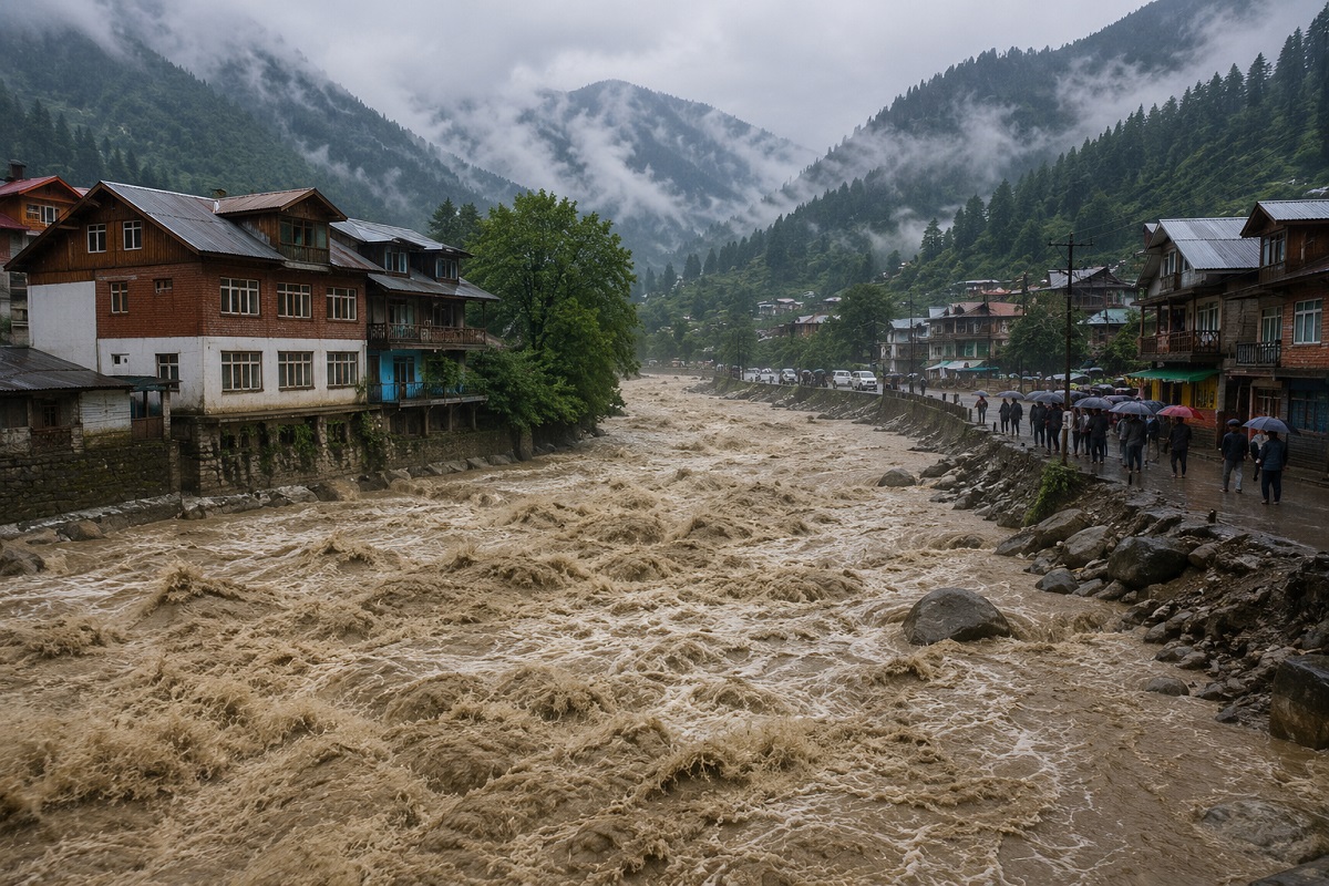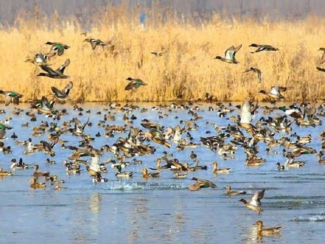
Official records identify wetlands, but authorities have struggled to establish their actual condition. From a missing wetland in Baramulla to pollution in Jammu and Kupwara, the latest NGT proceedings expose a deeper problem of mapping, monitoring and accountability.
By: News Desk | 09 November 2026
Srinagar, Jammu & Kashmir: A wetland can disappear in more than one way. It can shrink gradually as water recedes, lose its natural flow because of construction or drainage, become choked with waste, or slowly give way to cultivation and other land uses. Sometimes, the most troubling sign is not a visibly shrinking lake but a gap between what government records describe and what an inspection finds on the ground.
That gap is now at the centre of an important environmental proceeding before the National Green Tribunal (NGT).
The Tribunal has asked the Jammu and Kashmir Pollution Control Committee (JKPCC) to prepare a fresh assessment of wetlands and establish their actual existing area. The committee must compare the physical extent of each identified wetland with the area recorded in revenue documents and submit an updated report before the next hearing on February 26, 2027.
The direction follows the Tribunal’s observation that the previous report contained revenue-area details but did not establish how much of each wetland actually remained.
It is a seemingly technical instruction. Its implications, however, are considerable. Without reliable boundaries and ground-level measurements, it becomes difficult to establish the extent of wetland loss, identify encroachment, plan restoration or determine which authority is responsible.
And the latest findings suggest that the problem extends well beyond missing figures.
How the NGT proceedings began
The current scrutiny did not emerge overnight.
In March 2024, the NGT registered a suo motu case after taking note of a Kashmir Life report titled What Challenges Are Kashmiri Wetlands Facing?, published on February 2 that year.
The concerns raised included sediment accumulation, the gradual shallowing of wetlands, changes in water quality, encroachment, cultivation activities and the discharge of waste into water bodies.
The Tribunal treated the matter as a serious environmental issue involving compliance with the Wetlands (Conservation and Management) Rules, 2017, and the Environment (Protection) Act, 1986.
The Jammu and Kashmir Pollution Control Committee, the Union Territory Wetland Authority, the Forest Department, the Central Pollution Control Board and the Union Environment Ministry were brought into the proceedings.
This was significant because the issue was no longer being treated simply as a matter of local cleanliness or individual encroachment. It involved the larger question of whether government agencies were identifying, protecting and monitoring wetlands in accordance with environmental requirements.
The proceedings also brought earlier water-quality assessments into focus. Reports submitted by authorities referred to problems involving biochemical oxygen demand, dissolved oxygen and other water-quality parameters at several wetlands.
The case has since developed into a wider examination of the condition of water bodies and the quality of information being supplied by the administration.
The 27 wetlands and another round of incomplete information
A major development came in August 2026, when the JKPCC informed the NGT that it had identified 27 wetlands measuring more than one hectare.
These wetlands were located outside forest areas.
The identification initially appeared to be an important step towards improving the official inventory. But the Tribunal was not satisfied with the information presented.
In its August 18 proceedings, the NGT pointed out that the Geographic Information System (GIS) area column in the submitted table was highlighted in black, making the figures difficult to read. It directed the committee to provide complete information, including the area of the wetlands, encroachments, water-quality analysis and possible sources of pollution.
The next hearing was scheduled for November 6.
The JKPCC subsequently submitted a report dated October 1, 2026. However, the latest proceedings revealed another significant gap.
The committee had supplied the revenue area of the identified wetlands, but it had not established their actual existing area. Information from the Deputy Commissioners of Jammu and Kupwara was also still awaited.
The NGT therefore directed the JKPCC to obtain the missing details and present a comparison between the area recorded in official revenue documents and the area that exists physically.
The fresh report must be filed at least one day before the next hearing on February 26, 2027.
There is an important limitation here. The 27 wetlands represent a particular category of identified water bodies measuring more than one hectare outside forest areas. They should not be mistaken for a complete inventory of every wetland, marsh, lake and seasonal water body in Jammu and Kashmir.
The next assessment must explain its coverage clearly. Otherwise, a report that appears comprehensive could still leave large parts of the wetland landscape outside the exercise.
Baramulla’s missing wetland: a warning that needs investigation
One of the most disturbing findings concerns Rakh-i-Dastipora wetland in Baramulla.
According to information from the district administration placed before the Tribunal, the wetland could not be found at its recorded location in its original form. The land in the estate was reportedly being used for paddy cultivation.
This raises questions that cannot be answered by a simple entry in a government register.
When was the wetland last physically verified? What was its original boundary? Was the land formally demarcated? When did cultivation become the dominant land use? Were any permissions granted, and which authority was responsible for monitoring the site?
These questions matter because the absence of a visible wetland does not, by itself, establish who caused its disappearance or whether a specific individual committed an offence. That requires examination of cadastral records, historical satellite imagery, land-use changes and the legal status of the property.
But the finding is still alarming.
If a water body remains listed in official records while its original wetland characteristics can no longer be identified on the ground, the administration needs to establish what happened and when.
The case also demonstrates why a revenue entry cannot be treated as proof that a wetland is still functioning as an ecosystem.
A wetland is not simply a parcel of land with a name attached to it. Its ecological character depends on water movement, soil conditions, vegetation, seasonal flooding and the relationship between the wetland and its surrounding catchment.
Pollution is another part of the crisis
The JKPCC report also highlighted water-quality concerns across several districts.
The findings placed before the Tribunal showed that none of the three samples tested in Jammu district met the prescribed Class B primary water-quality criteria for organised outdoor bathing.
In Samba, only two of the nine samples met the prescribed standards. The sample collected from the Janglote wetland in Kathua, however, complied with the criteria.
In Kashmir, four of the six wetlands tested in Kupwara failed to meet the Class B standards, mainly because of high biochemical oxygen demand (BOD). Rakh-i-Dastipora in Baramulla also failed the prescribed parameters for BOD and dissolved oxygen.
The report further identified domestic effluent entering Mawasar wetland in Samba as a source of pollution.
There are important distinctions in these findings. No encroachment was reported in the surveyed wetlands in Samba, while the Janglote wetland in Kathua was not reported to have a pollution source or encroachment. The findings therefore do not suggest that every surveyed wetland faces identical problems.
They do, however, indicate that water quality requires attention alongside the physical protection of wetland boundaries.
What do BOD and dissolved oxygen tell us?
Biochemical oxygen demand measures how much oxygen microorganisms consume while breaking down organic matter in water.
When large quantities of organic waste enter a water body, microbial activity can consume more oxygen. This can reduce dissolved oxygen levels and place aquatic organisms under stress.
The Central Pollution Control Board’s Class B criteria relate specifically to water used for organised outdoor bathing. They include dissolved oxygen of at least 5 mg per litre and BOD of no more than 3 mg per litre, along with other parameters.
These are not drinking-water standards, nor do they provide a complete assessment of a wetland’s ecological health.
A wetland can have problems involving sedimentation, invasive vegetation, altered water flows, habitat loss or biodiversity even when a limited set of water-quality measurements appears satisfactory.
That is why the next assessment should not rely on a few water samples alone. It needs to examine the condition of the entire wetland system.
The JKPCC has reportedly written to its regional directors seeking information about the individuals, agencies and departments responsible for environmental violations so that corrective and punitive action can be considered.
That is a necessary step. But identifying responsibility and demonstrating that action has actually followed are two different things.
The figures reveal a much larger history of water-body loss
The latest NGT proceedings must be viewed against the wider history of wetland and lake degradation in Jammu and Kashmir.
A performance audit by the Comptroller and Auditor General (CAG), presented in the Legislative Assembly on March 30, 2026, examined the conservation and management of lakes in the Union Territory.
The report recorded 697 natural lakes in its inventory. By comparing their historical water spread with later data, the audit found that 518 had either disappeared or reduced in area.
The breakdown is significant:
- 315 lakes had disappeared completely.
- 203 lakes had experienced a reduction in water spread.
- The combined reduction in water area for these 518 lakes was estimated at approximately 2,851.26 hectares.
- 63 lakes had lost at least half of their water spread.
The audit also recorded that 150 lakes had gained 538.22 hectares of water area, while 29 had remained unchanged. However, the reasons for the increase in water spread were not adequately monitored or analysed by the concerned departments.
This is an important detail. The CAG findings are not simply a claim that every lake has continuously shrunk. They show a pattern of major losses, some increases and inadequate monitoring of changes across the wider lake inventory.
There is also a numerical discrepancy in some earlier news coverage. A PTI report published in August referred to 518 affected lakes out of 687. The CAG’s primary audit report, however, clearly records 697 natural lakes. The official figure of 697 is therefore the appropriate number to use when quoting the audit.
The audit’s historical comparison also needs context. It examined lake-area changes against a 1967 baseline, using later reference data from 2014 for Kashmir and 2020 for Jammu. It is not a live measurement of every lake in November 2026.
Even with that qualification, the scale of the recorded change is difficult to ignore.
Why two official datasets show different levels of wetland loss
Another set of figures comes from the Ministry of Statistics and Programme Implementation’s EnviStats India 2022: Volume II, Environment Accounts.
According to this inventory, the recorded wetland area in Jammu and Kashmir declined from 164,230 hectares in 2006-07 to 164,110 hectares in 2017-18. That represents a reduction of 120 hectares, even as the number of listed wetlands increased from 403 to 404.
At first glance, this may appear inconsistent with the CAG’s estimate of more than 2,851 hectares of lost lake water spread.
The figures, however, should not be directly compared as though they measure the same thing.
The MOSPI inventory uses a decadal wetland inventory and change analysis. The CAG assessment examines the water spread of a separate inventory of 697 natural lakes over a much longer historical period. Their categories, reference years and measurement methods differ.
The 120-hectare figure is not proof that total lake and wetland loss across J&K has been limited to that amount. Equally, the 2,851-hectare figure should not be described as a direct measurement of every wetland’s decline over the same decade.
The difference underlines the need for a common, updated and transparent inventory.
Without consistent definitions, mapped boundaries and reference dates, government departments can produce numbers that are technically correct within their own datasets but difficult to reconcile into a single picture of ecological change.
The governance problem: several agencies, no single picture
The CAG audit points to a problem that goes beyond the quality of the latest JKPCC report.
It found that conservation and management programmes had been prepared for only six of the 697 lakes examined in the wider inventory: Dal, Wular, Hokersar, Manasbal, Surinsar and Mansar.
For the remaining 691 lakes, the audit found that the government had neither identified eligible lakes for assistance under relevant central programmes nor prepared the required conservation and management plans.
The report also identified fragmented responsibilities among departments and authorities.
The Forest, Revenue, Agriculture, Housing and Urban Development, and Tourism departments had roles connected with lake management. Several other institutions were involved in environmental functions.
The CAG found that there was no centralised, lake-specific development and regulatory authority with a clear mandate to ensure coordinated conservation and monitoring. It also pointed to shortages of technical staff, including hydrologists, ecologists, remote-sensing specialists and other experts.
This distinction is important. Jammu and Kashmir does have a Union Territory Wetland Authority under the national wetland framework, as well as a dedicated Wetlands Division within the Wildlife Protection Department. The CAG’s criticism was not that no environmental institution existed. It was that responsibilities remained divided and that the wider lake-management system lacked adequate coordination, technical capacity and comprehensive planning.
When different agencies hold different maps, records and responsibilities, it becomes difficult to answer a basic question: who is accountable when a wetland loses its area or ecological character?
Government programmes exist, but implementation must be measured
The administration has also placed details of conservation efforts before the NGT.
In a 2024 filing, the Forest Department stated that the Wetlands Division Kashmir was implementing an Integrated Management Action Plan for 2022-27. It reported regular water-quality testing, community cleanliness drives and the installation of 252 dustbins out of 360 proposed for the wetlands under its management.
The department also reported that mechanised trash guards had been installed at the entry points of Hokersar and Shallabugh to prevent solid waste from entering the wetlands.
It further proposed 11 artificial wetlands around peripheral villages to help manage diffuse pollution. The department’s filing stated that an earlier tender had not been executed because of a poor response and that the work was expected to be taken up during 2025-26.
These steps deserve recognition, but they must be assessed against measurable environmental outcomes.
How much waste is actually being prevented from entering the wetlands? Has water quality improved? Have the proposed artificial wetlands been constructed? Have encroachments been removed? Have the boundaries of the protected wetlands been demarcated?
A cleanliness drive is useful, but it cannot substitute for sewage treatment, hydrological restoration, scientific monitoring and enforcement of land-use restrictions.
There is also a difference in coverage. The Integrated Management Action Plan cited by the Forest Department concerns specific wetland conservation reserves. It does not automatically mean that all 697 lakes identified in the CAG inventory are covered by equally detailed conservation programmes.
The gap between planned work and verified results remains one of the central questions.
What the law says about encroachment and pollution
India’s Wetlands (Conservation and Management) Rules, 2017 provide a regulatory framework for the conservation and management of wetlands covered by the Rules.
Among the prohibited activities within notified wetlands are conversion to non-wetland uses, including encroachment, solid-waste dumping, discharge of untreated waste and effluent, and certain permanent construction.
The framework also provides for State and Union Territory Wetland Authorities, identification and delineation of wetlands, preparation of management plans and enforcement of relevant rules.
However, the legal status of each water body matters. The Rules apply to Ramsar wetlands and wetlands notified by the government, subject to specified exclusions for areas covered under certain other laws. Not every pond, marsh or lake automatically has the same protection status under the Rules.
This makes accurate mapping even more important.
Jammu and Kashmir has five Ramsar sites listed in the Ministry of Environment, Forest and Climate Change’s January 2026 inventory: Wular Lake, Surinsar-Mansar Lakes, Hokera Wetland, Hygam Wetland Conservation Reserve and Shallbugh Wetland Conservation Reserve.
These internationally recognised sites are important, but conservation cannot stop at their boundaries. Smaller wetlands, seasonal marshes and local water bodies also contribute to the region’s ecological balance.
Why losing wetlands can make floods more dangerous
Wetlands are often treated as empty land waiting for development. That is a serious misunderstanding.
They are natural parts of the hydrological system. Depending on their location and condition, they store excess water, slow runoff, support groundwater recharge, trap sediment, improve water quality and provide habitat for fish, plants and birds.
Their role in flood management is particularly important in a region shaped by rivers, streams, snowmelt and seasonal rainfall.
The CAG audit specifically observed that the disappearance and reduction of lake areas had damaged ecological systems and reduced natural flood-balancing capacity. It identified wetland and lake shrinkage as one of the factors associated with the devastating floods of September 2014.
This does not mean that wetland loss alone caused the 2014 floods. Flooding is influenced by rainfall, river discharge, drainage capacity, land use and other factors. But the loss of natural water-storage areas can reduce the landscape’s ability to absorb and regulate excess water.
The consequences are not limited to floods.
Degraded wetlands can affect groundwater, fisheries, local livelihoods, migratory bird habitats and biodiversity. Once a wetland’s natural water regime is disrupted, restoring it can become expensive and technically difficult.
What the next JKPCC report must actually establish
The February 2027 hearing could become an important turning point, but only if the next report goes beyond another collection of tables.
A credible assessment should include:
1. Georeferenced boundaries: Each wetland should have a clearly defined boundary supported by GIS mapping, GPS-based field verification and cadastral records.
2. Historical comparison: Satellite imagery from different years should be used to identify changes in water spread, vegetation, construction, cultivation and other land uses. Seasonal differences must be taken into account.
3. Ground verification: Officials should physically inspect the sites and document whether mapped wetlands still exist, whether their boundaries have changed and whether water channels have been blocked.
4. Encroachment details: Where violations are found, the report should identify the affected area, nature of the activity, relevant land records and the department responsible for enforcement.
5. Water-quality assessment: Testing should cover relevant pollution parameters and be repeated at appropriate intervals. A single sample cannot represent the long-term condition of a wetland.
6. Restoration priorities: The report should identify wetlands requiring immediate intervention, including sewage control, removal of solid waste, restoration of natural water flows and protection of habitats.
7. Public accountability: Findings should be made available in a form that residents, researchers and local institutions can examine. Each major recommendation should carry a responsible department and a clear implementation timeline.
Satellite mapping will be valuable, but it cannot replace field investigation. Wetlands change with seasons, rainfall and water levels. A proper assessment must distinguish temporary seasonal variation from permanent loss or conversion.
Local residents, farmers, fishers and communities living around these water bodies should also be consulted. Their observations can help investigators understand changes that may not be obvious from a single satellite image.
The real test comes after the report
The NGT’s latest direction has brought an important question into the open: can Jammu and Kashmir establish the actual condition of its wetlands with reliable, verifiable evidence?
The findings already available suggest that the challenge is serious. A wetland in Baramulla could not be located at its recorded site. Water-quality concerns have emerged in several districts. The CAG has documented extensive historical reductions in lake water spread and shortcomings in conservation planning. Earlier government filings show that programmes exist, but they also reveal delays and uneven coverage.
Yet the Tribunal has not, through this latest direction, ordered a blanket eviction campaign or declared particular individuals guilty of encroachment. It has asked for a better assessment. Any enforcement action must follow verified findings and the applicable legal process.
That is why February 26, 2027, matters.
If the JKPCC produces a transparent, scientifically sound report, the proceedings could help establish a reliable baseline for wetland protection. If it submits another incomplete document, the region will remain trapped in a familiar cycle: records will exist, committees will meet, plans will be announced, but the actual condition of water bodies will remain uncertain.
Jammu and Kashmir cannot protect wetlands that it has not properly mapped, measured and monitored.
The question is no longer only how many wetlands appear in government records. It is whether those wetlands still function, how much of their original area survives, who is responsible for the damage and what will be done to prevent further loss.
The next report must provide those answers. Anything less will leave the most important part of the NGT’s exercise unfinished.