Kashmir’s Rivers Are Running Low. What Happens If the Dry Spell Continues Into December?
Water levels across the Jhelum basin have dropped sharply at multiple monitoring stations, while Wular Lake stands 4.10 metres below its cited reference mark. With little precipitation expected in the coming days, the warning extends beyond rivers to springs, drinking water supplies, irrigation and hydropower.
By: Javid Amin | 20 November 2026 | Srinagar – Kashmir
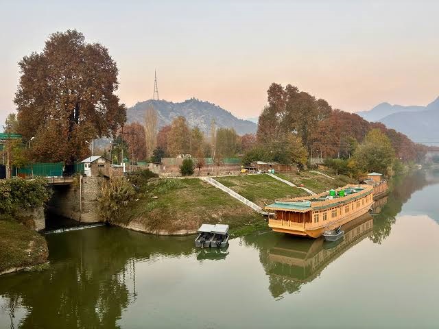
Kashmir’s rivers are sending a worrying signal this November. From Sangam in South Kashmir to Asham in the north, the Jhelum is flowing at unusually low levels, while several of its major tributaries are showing similarly depleted readings. Wular Lake, one of the Valley’s most important freshwater ecosystems, is also significantly below its cited reference level.
The numbers paint a picture of widespread water stress across the river system, coming at a time when Kashmir is entering winter with little rainfall or snowfall expected to replenish its natural water reserves in the immediate future.
The concern is not simply that rivers look thinner or their banks have become more exposed. The Jhelum and its tributaries form a connected hydrological system that supports drinking water sources, agriculture, wetlands, fisheries, ecosystems and hydropower generation. When several components of this system register low levels simultaneously, the consequences can extend well beyond the riverbanks.
According to gauge readings reported on November 20, the Jhelum was at minus 0.64 feet at Sangam, 3.81 feet at Munshi Bagh in Srinagar and 1.30 feet at Asham. At Pampore, the river was recorded at 1.01 metres. Wular Lake stood at 1,573.90 metres, against a cited reference level of 1,578 metres.
The figures are not isolated. Vishow Nallah, Rambiyara, Lidder, Doodhganga and Sindh Nallah are also flowing considerably below their respective reference marks.
The immediate explanation is a prolonged absence of precipitation. But the wider question is increasingly difficult to ignore: how prepared is Kashmir to deal with a winter in which its natural water sources begin the season already under pressure?
Jhelum’s low levels stretch across the Valley
The latest reported readings show that low water levels are being observed at multiple locations along the Jhelum rather than at a single isolated station.
| Monitoring station | Latest reported level | Reference mark |
|---|---|---|
| Sangam | -0.64 ft | 21 ft |
| Munshi Bagh, Srinagar | 3.81 ft | 18 ft |
| Asham | 1.30 ft | 14 ft |
| Pampore | 1.01 m | 4.50 m |
| Wular Lake | 1,573.90 m | 1,578.00 m |
Source: Gauge readings reported on November 20, 2026. Units and reference marks differ by station.
The Sangam reading of minus 0.64 feet is particularly striking. However, negative gauge readings must be understood in the context of the station’s measurement datum. They do not mean that the river contains negative water or has physically fallen below the riverbed.
Likewise, the reference marks listed for individual stations should not automatically be interpreted as seasonal average water levels, normal flow targets or drought thresholds. Gauge readings are useful for monitoring changes, but assessing the severity of hydrological drought requires additional information, including discharge, historical seasonal records, rainfall and snow accumulation.
What is concerning here is the overall pattern. Multiple monitoring stations are recording low levels, and the conditions are unfolding during a prolonged precipitation deficit.
Tributaries are showing the same signs of stress
The tributaries feeding the Jhelum are equally important because they supply water from different parts of the Valley’s landscape.
| Tributary and location | Recorded level | Reference mark |
|---|---|---|
| Vishow Nallah, Khudwani | 2.41 m | 7.75 m |
| Rambiyara Nallah, Wachi | -0.44 m | 5.40 m |
| Lidder Nallah, Batkoot | -0.66 m | 1.50 m |
| Doodhganga, Barzulla | 0.26 m | 3.65 m |
| Sindh Nallah, Doderhama | -0.40 m | 3.65 m |
These streams drain different catchments, including mountainous terrain, forests, agricultural areas and populated settlements. Their flow is influenced by precipitation, snowmelt, groundwater contributions, geology, seasonal conditions and human withdrawals.
The low readings suggest that the dry conditions are affecting multiple parts of the Valley’s water network.
Yet these measurements should not be treated as a direct comparison of the volume of water flowing through each stream. The stations use different reference levels and, in some cases, different units. River-stage height alone cannot tell us how much water is being discharged per second.
To establish the actual decline in water availability, the Irrigation and Flood Control Department would need to publish discharge measurements alongside gauge levels and compare them with long-term seasonal averages.
That information would help determine whether the current situation is simply a seasonal low-flow period or developing into a more serious hydrological drought.
Wular Lake is 4.10 metres below its cited reference level
The condition of Wular Lake adds another dimension to the concern.
The lake was recorded at 1,573.90 metres, against a cited reference level of 1,578 metres, leaving a difference of 4.10 metres.
Wular is not merely a large body of water. It plays a critical role in Kashmir’s ecological and hydrological landscape. It supports fisheries, livelihoods, biodiversity and water-related activities while helping regulate the flow of water within the Jhelum basin.
A low lake level can expose shallow margins, alter the connectivity of wetland habitats, affect fish breeding and influence the condition of vegetation. But the ecological consequences depend on where water has receded, how long the levels remain low, the condition of the lake’s channels and the extent of its seasonal fluctuations.
The reported 4.10-metre difference should therefore not be confused with a uniform reduction in the lake’s depth. It is a difference between the recorded level and the cited reference mark, not a measurement showing that the entire lake has lost 4.10 metres of water depth.
Even with that distinction, prolonged low levels deserve close monitoring, particularly because Wular is already facing broader conservation challenges involving sedimentation, pollution, altered inflows and changes in its surrounding land use.
A lake’s health cannot be judged by water level alone, but water level remains one of the most important indicators of changes occurring within its ecosystem.
Kashmir’s dry spell is becoming the bigger concern
The low river readings are coinciding with an extended period of largely dry weather.
The Meteorological Centre Srinagar has indicated generally dry conditions across Jammu and Kashmir through November 27. Independent weather assessments suggest that the lack of significant precipitation could continue for around 10 to 15 days, potentially extending into early December.
The India Meteorological Department’s forecasts in mid-November indicated precipitation associated with western disturbances over the Western Himalayan region. However, the anticipated weather systems did not translate into sustained precipitation capable of replenishing the Valley’s water resources.
The latest outlook suggests that a weak western disturbance may affect the Western Himalayan region during the following week, while broader precipitation forecasts indicate below-normal rainfall over much of the country.
That does not mean Kashmir will necessarily remain completely dry every day. Weather forecasts can change, and isolated precipitation may occur. The concern is the absence of a sustained, substantial precipitation event capable of reversing the downward trend in water levels.
Kashmir’s winter precipitation is especially important because snowfall accumulated in the mountains contributes to river flows through snowmelt during subsequent months. Rainfall and snowfall also replenish soils, groundwater systems and local springs.
When this replenishment is delayed, the effects can become visible first in smaller water bodies and streams, which often have less storage capacity than major rivers.
Springs are the first to feel the pressure
The situation may be more serious for communities that depend on springs, small streams, local water channels and natural sources rather than large municipal systems.
Reports from parts of South Kashmir have indicated that some traditional springs have dried up following prolonged dry weather.
These sources are particularly vulnerable because their availability depends on local groundwater recharge, which is influenced by rainfall, snowfall, soil infiltration, geology and the condition of the surrounding catchment.
A spring may continue to flow during the early stages of a dry spell because it draws from groundwater stored underground. But if that storage is not replenished, discharge can weaken or stop.
The process is not always immediate. Some springs respond quickly to changes in precipitation, while others are sustained by deeper or more extensive groundwater systems and may respond after a delay.
This makes the current situation important even if no widespread drinking water emergency has been declared.
The people most exposed may be those living in rural areas, higher elevations and settlements where drinking water infrastructure is limited or where natural sources remain essential for daily use.
For these communities, a drying spring is not an abstract climate indicator. It can mean longer walks for water, increased dependence on tanker supplies, additional costs for households and growing pressure on local water infrastructure.
Could drinking water supplies come under pressure?
At present, officials and weather observers have not indicated that Kashmir is facing an immediate Valley-wide drinking water emergency.
But the distinction between an immediate crisis and a developing risk matters.
Water supply systems depend not only on the amount of water available in rivers and lakes, but also on the reliability of intake points, pumping stations, treatment facilities, groundwater sources and distribution networks.
If river levels continue declining, certain intake points may require adjustments. Smaller sources could become less dependable, while water supply schemes dependent on springs or streams may experience reduced availability.
The administration would need to assess vulnerable schemes individually rather than assume that low river gauges translate directly into shortages everywhere.
A timely assessment should identify areas dependent on low-flow natural sources, check the condition of existing storage facilities, verify backup arrangements and determine whether tanker deployment may become necessary.
Waiting until households begin reporting shortages would be a reactive approach. The current readings provide an opportunity for departments to prepare before conditions worsen.
Hydropower faces a seasonal challenge too
Kashmir’s power sector is also closely connected to water availability.
Much of the region’s hydropower generation depends on river flows, diversion systems and water availability at individual projects. Reduced inflows can affect generation at run-of-river power stations, particularly those with limited storage capacity.
However, low river levels do not automatically translate into a fixed reduction in electricity production. The impact depends on the water discharge available at each project, operational requirements, reservoir or pondage conditions, plant design and the overall power allocation system.
The immediate concern is therefore not that power generation will necessarily collapse, but that prolonged low inflows could add pressure to the power sector at a time when electricity demand rises during winter.
Kashmir already enters the colder months with substantial heating-related electricity demand. If precipitation remains deficient and hydropower availability is affected, the region’s dependence on electricity imports and other sources of supply may increase.
The power authorities should monitor inflows at major hydropower projects and publish assessments of any expected generation impact rather than waiting for the winter peak to reveal the extent of the problem.
Why a dry November matters beyond November
A prolonged dry spell at the beginning of winter can have consequences that continue well after the weather changes.
The first concern is groundwater recharge. Rain and snow contribute to the replenishment of groundwater, but the extent and timing depend on soil conditions, snow accumulation, temperature, geology and the nature of the catchment. A precipitation deficit may reduce the amount of water entering these systems.
The second is agriculture. Although much of the Valley’s agricultural activity follows seasonal cycles, soil moisture conditions and water availability can influence orchard management, irrigation requirements, winter crops and preparations for the next growing season.
The third is ecosystem health. Reduced flows can affect aquatic habitats, wetland connectivity, fish movement and the ability of streams to dilute pollutants. Water quality can deteriorate when discharge is low and pollutants continue entering a river.
The fourth is the cumulative impact of repeated dry periods. One dry spell may not cause long-term damage, particularly if precipitation returns. But repeated deficits, combined with warming temperatures, changing snow patterns, land-use pressures and excessive groundwater extraction, can increase vulnerability over time.
This is where the current situation needs to be examined through a longer-term climate and hydrological lens.
Is climate change responsible for the low levels?
It would be premature to attribute the November 2026 low water levels entirely to climate change.
The immediate cause identified in the latest reports is a prolonged dry spell and lack of significant rainfall or snowfall. Climate change can influence precipitation patterns, temperature, evaporation, snow accumulation and melt timing, but establishing its role in a particular low-flow event requires scientific analysis.
Researchers would need to compare the current conditions with historical records, examine precipitation deficits across the catchment, analyse snow cover and snow-water equivalent, assess temperature trends and study river discharge over several decades.
Kashmir’s water system is particularly sensitive to changes in both winter precipitation and temperature. A change in the balance between snowfall and rainfall can influence the timing of water availability. Earlier snowmelt, reduced snow accumulation or extended dry periods may alter seasonal river flows.
The challenge is that the Valley is not simply getting more or less water in a straightforward manner. The timing, location, form and duration of precipitation all matter.
A river may receive substantial water during a short period but still face reduced flows during the months when communities and ecosystems need a steady supply.
The current dry spell is a warning to improve hydrological monitoring, not an excuse to make unsupported climate claims.
Kashmir needs a water monitoring system that looks beyond flood danger
Jammu and Kashmir has developed river monitoring and flood-warning infrastructure primarily to track rising water levels and identify flood risks.
The same infrastructure can provide valuable information during low-flow periods, but its public reporting needs to be more comprehensive.
The River Watch system operated by the Irrigation and Flood Control Department provides station readings and identifies levels in relation to warning thresholds. The latest records show several stations below warning levels, which is consistent with the reported low-water conditions.
But flood monitoring and drought monitoring are not identical.
A river can remain below flood-warning levels while experiencing serious ecological or water-supply stress. Flood thresholds are designed to identify dangerous high-water conditions, not to determine whether water availability is sufficient for drinking, irrigation, ecological flow or hydropower.
Kashmir needs an integrated monitoring system that tracks both extremes.
Such a system should include:
- River discharge in cubic metres per second, not gauge height alone.
- Historical seasonal averages and low-flow thresholds.
- Groundwater levels and spring discharge.
- Precipitation deficits across individual catchments.
- Snow accumulation and snow-water equivalent.
- Wetland and lake levels.
- Drinking-water supply vulnerability.
- Hydropower inflows and generation impacts.
The information should be updated regularly and made accessible to the public, especially during prolonged dry spells.
The administration must prepare before shortages appear
The present situation does not call for panic. It calls for preparation.
The Jal Shakti Department should identify drinking-water schemes most vulnerable to declining source levels and ensure backup arrangements are ready. Local authorities should monitor springs and small streams, particularly in villages where households depend on them.
The Irrigation and Flood Control Department should continue monitoring the Jhelum and its tributaries, but it should also publish discharge trends and compare current readings with historical November and December data.
The power department should assess the possible effect of declining inflows on hydropower generation and winter supply planning.
Agriculture and horticulture departments should identify areas where water availability could become a concern if the precipitation deficit persists.
The administration should also encourage responsible water use. Conservation measures are useful, but they cannot replace the need for infrastructure, source protection, scientific monitoring and long-term planning.
A dry spell is a weather event. Water insecurity becomes a governance problem when the warning signs are visible but preparations are inadequate.
A warning written across Kashmir’s rivers
The Jhelum’s low levels, the decline in its tributaries and the reduced level of Wular Lake are not proof of an immediate catastrophe. Nor do the latest gauge readings establish that every water source across Kashmir is facing the same degree of depletion.
But the pattern is difficult to dismiss.
The Valley’s rivers and streams are entering winter with low readings, while precipitation remains limited. Smaller springs and natural sources are already drawing concern. Drinking water supplies, irrigation, hydropower and ecosystems could face increasing pressure if the dry spell continues.
Kashmir’s water security cannot depend on the hope that the next western disturbance will arrive in time.
The region needs reliable measurements, transparent data, contingency planning and a broader understanding of how its rivers, springs, lakes and groundwater interact.
The Jhelum has always reflected the changing seasons of Kashmir. This November, its falling levels are reflecting something else as well: the growing need to take water security seriously before a dry spell becomes a crisis.